
Fleet Street and Fleet Square in Swindon town centre.
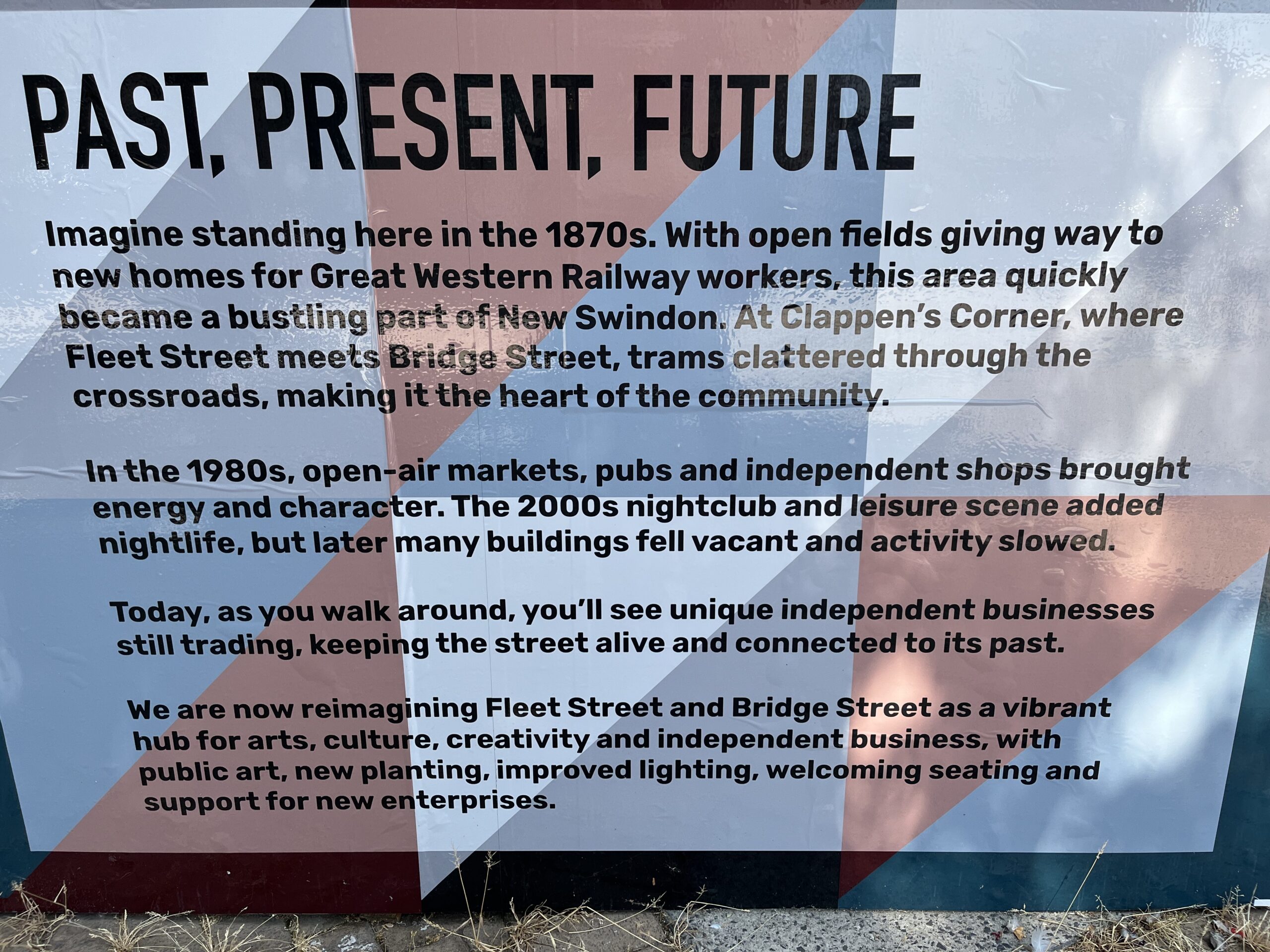
Way back in Swindon’s pre-history, before the completion of Brunel’s railway village, speculative builders began erecting houses just outside it. At first, these houses for the GWR workers stood in close comfort to the railway village along and just off a track known as Fleetway or Fletway – a term derived from Old and Middle English. Fleet/Flet meaning, amongst other things, a slow-moving watercourse and way, from Old English, is what you’d suppose – a road, path or track.
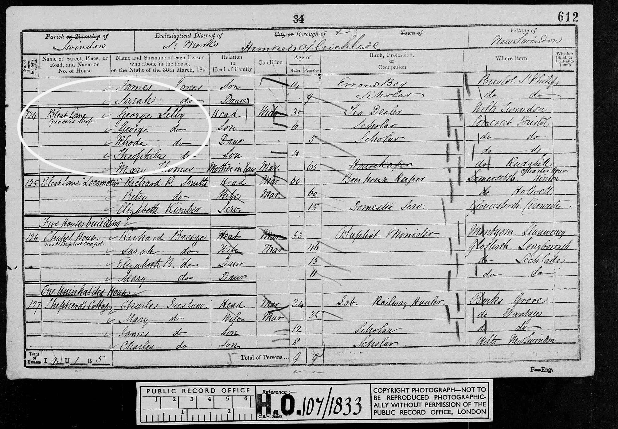
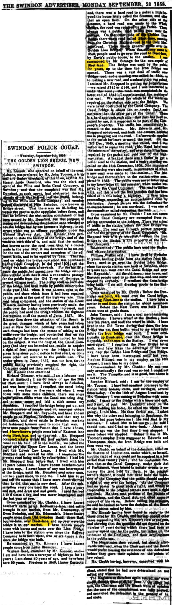
But this street, like so many, had an earlier name: Bleat/Bleet Lane. Local Studies inform me that Bleat/Bleet Lane may only have applied to part of the street because there’s records that show it as both Fleet Street and Fleetway all around the same time – the early 1800s. Thus, their best guess is that Bleat Lane and Fleetway were early names for parts of pre-existing streets before the bridge went across and extended/connected all the streets. Fleet Street then became all one run but the sections continued being referred to by those names until, at length, it all became Fleet Street.
Not only were street names variable, spellings were too. Thus this 1858 Swindon Advertiser article has it as Bleet Lane.
Today we know this ancient track as Westcott Place, Faringdon Road and Fleet Street. Small settlements became established on them as early as 1845.
Thus, as a green field site gave way to these new homes the area soon became a bustling part of New Swindon. When the railway village outgrew its shopping facilities (see Emlyn Square) this area had further retail offerings shoehorned into it – the potential for trade in Regent Street hadn’t yet been fully explored.
Tramlines
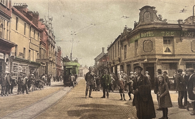
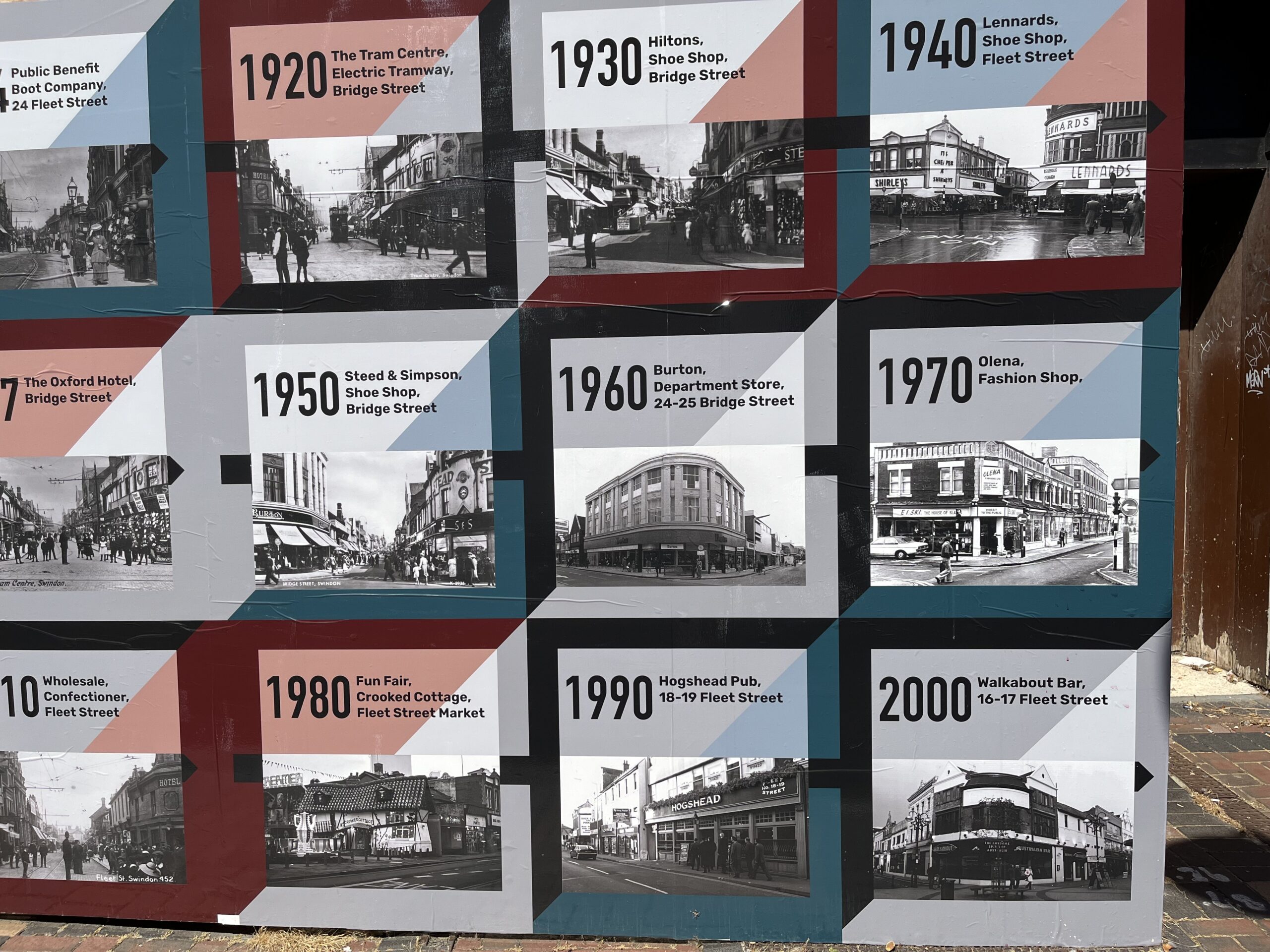
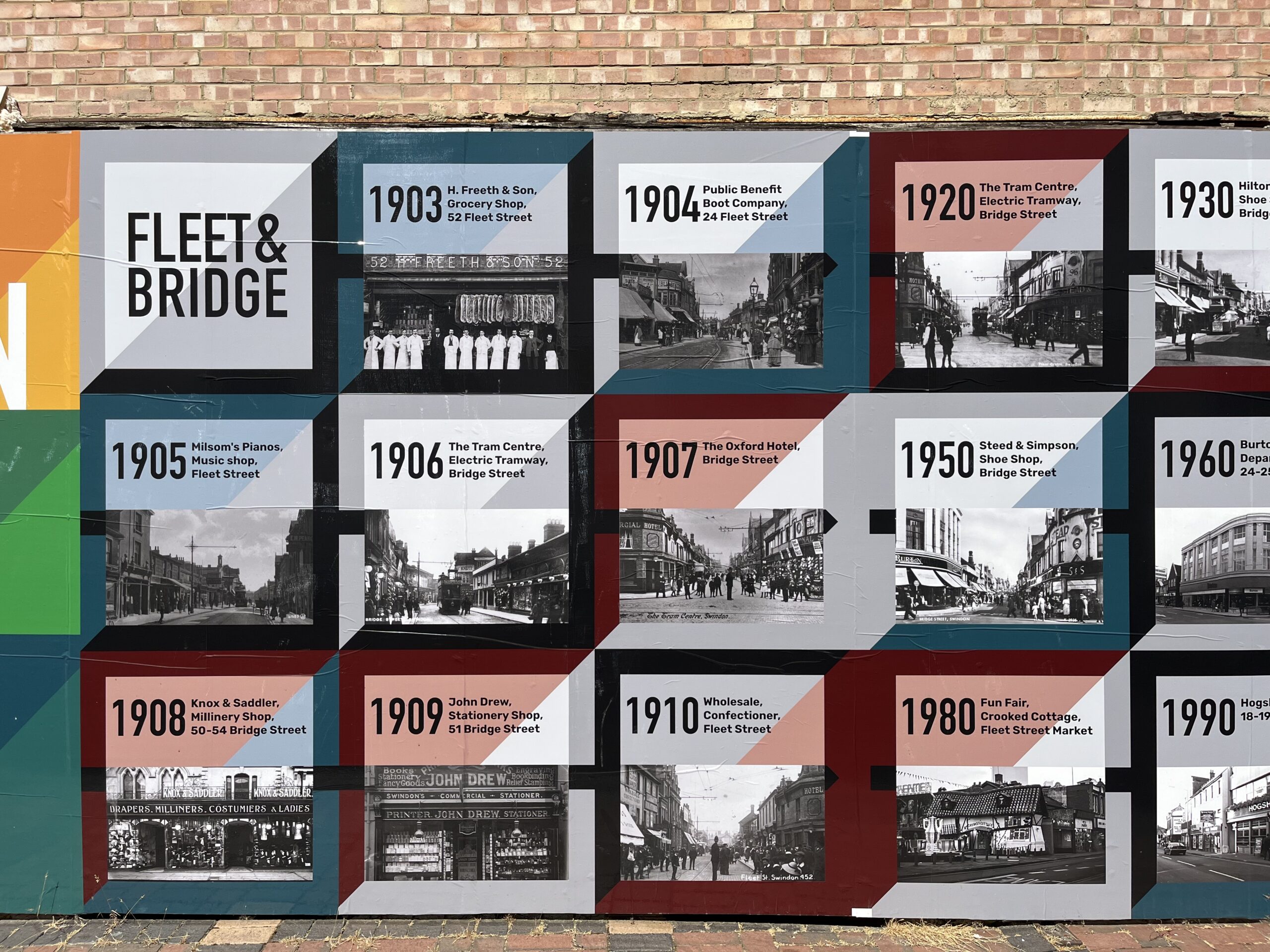
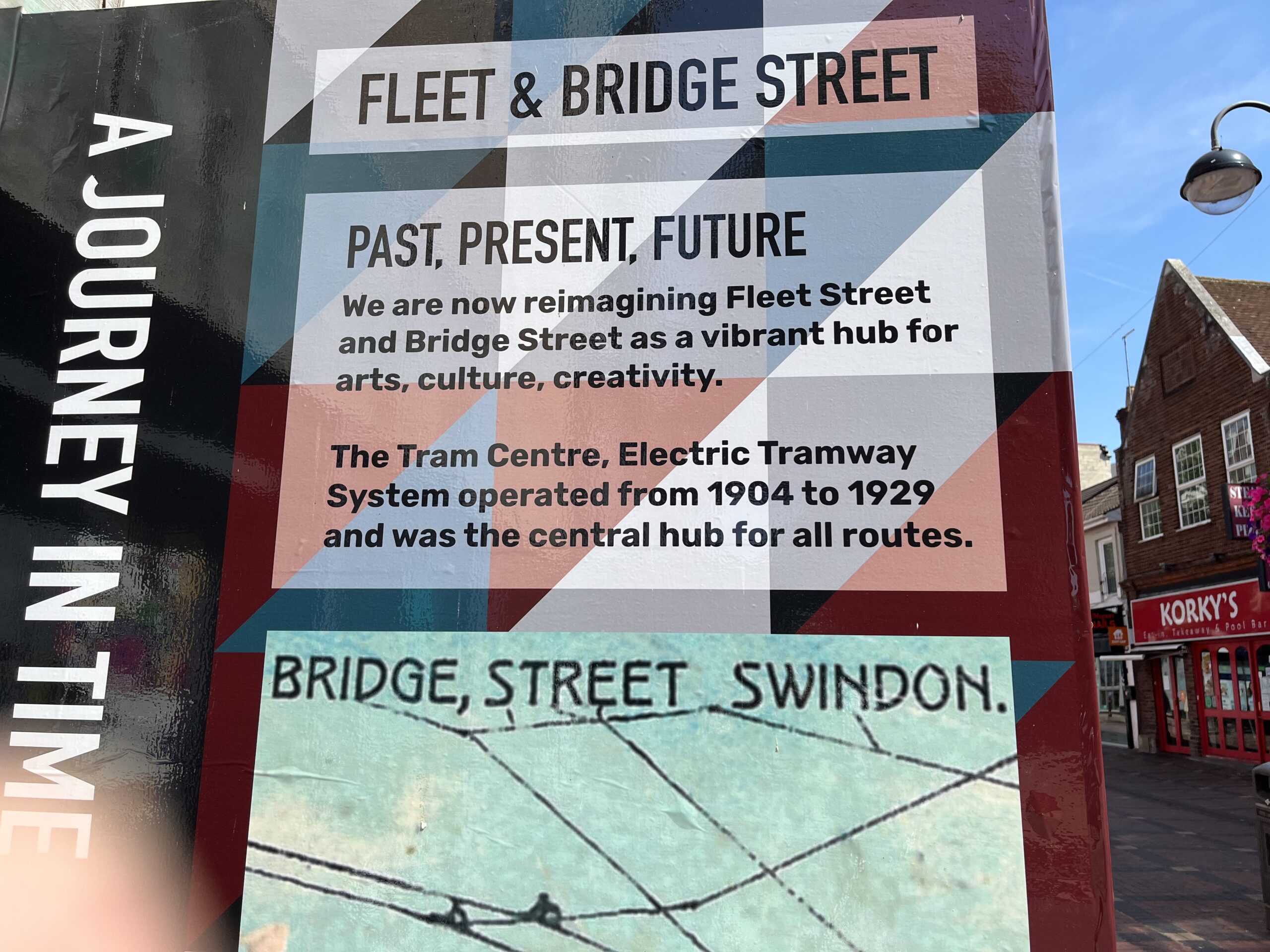
A distinguishing feature of the Fleet Street/Bridge Street junction was its function as the heart of Swindon’s tramways. The tramway opened on September 22, 1904 and had a depot in Corporation Street. A mere twenty-five years later they were phased out and it’s as if they never existed at all, so completely were they swept away by the new fangled omnibus.
Known variously as the tram centre, the centre or *Clappen’s Corner, from here one could take a tramcar to one of three destinations.
- Cricklade Road in Gorse Hill
- The Old Town Market Square and …
- … the far end of Rodbourne Road near the Bruce Street railway bridge.
The name Clappen’s Corner came from one William Clappen who ran a prominent clothing and millinery store on the right-hand corner of Fleet Street/Bridge Street. From 1905 to the early nineties the site became a Stead & Simpson shoe shop. This structure later had a date with the wrecking ball and Wilkinson’s (Wilko) built a purpose-built store there – it’s now vacated.
Referencing that ancient Fletway track, this modern building bears the name, Fleetway House.
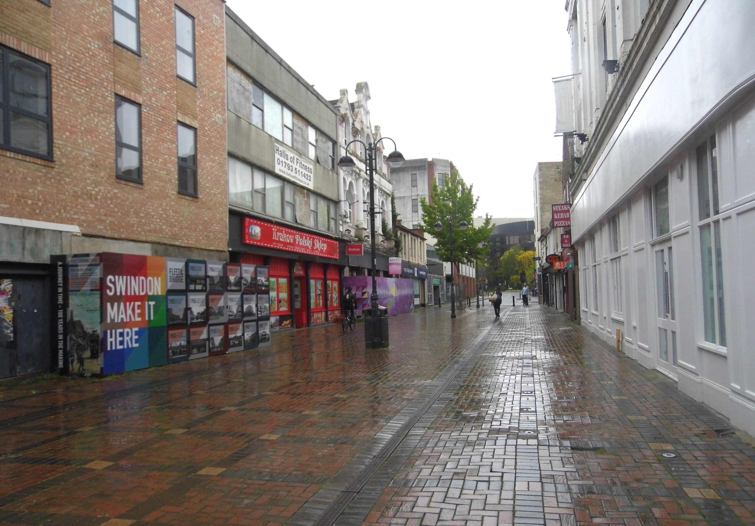
Below is the same view of Fleet Street. The left hand image from Local Studies is dated 1912 approx. The one on the right early 2000s.
Fleet Street today
Over the years the area has housed a busy outdoor market and numerous drinking establishments. There’s no pretending though that it hasn’t, let’s say, lost its shine, in recent years. Indeed, Fleet Street and Bridge Street are two bits of Swindon that make me sad. Though that’s not to say they’re not worth visiting. Indeed, in Swindon in 50 More Buildings I highlighted three buildings on Fleet Street that I felt worthy of mention. In the first instance because they’re interesting and in the second because the state of them concerned me. They are:
- The Public Benefit Boot company – or at least the premises that once served as that establishment.
- 20 Fleet Street – a building that began life as the North Wilts Conservative and Liberal Unionist Club.
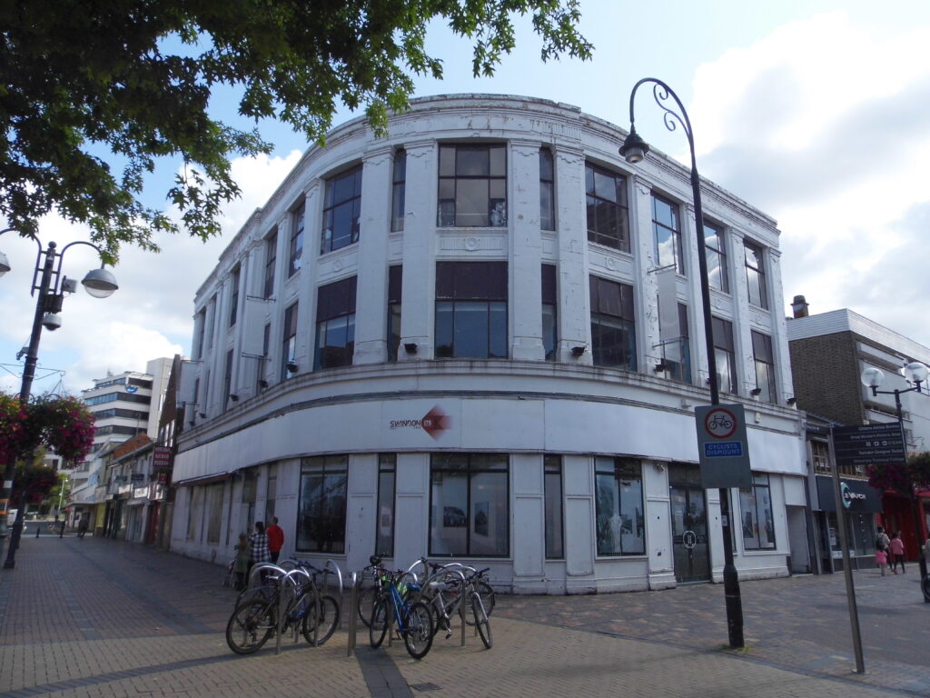
- The Burton building on the corner of Fleet Street/Bridge Street.

Scan of a 1908 postcard from Local Studies image collection.: 30th April 1908, East
Murals
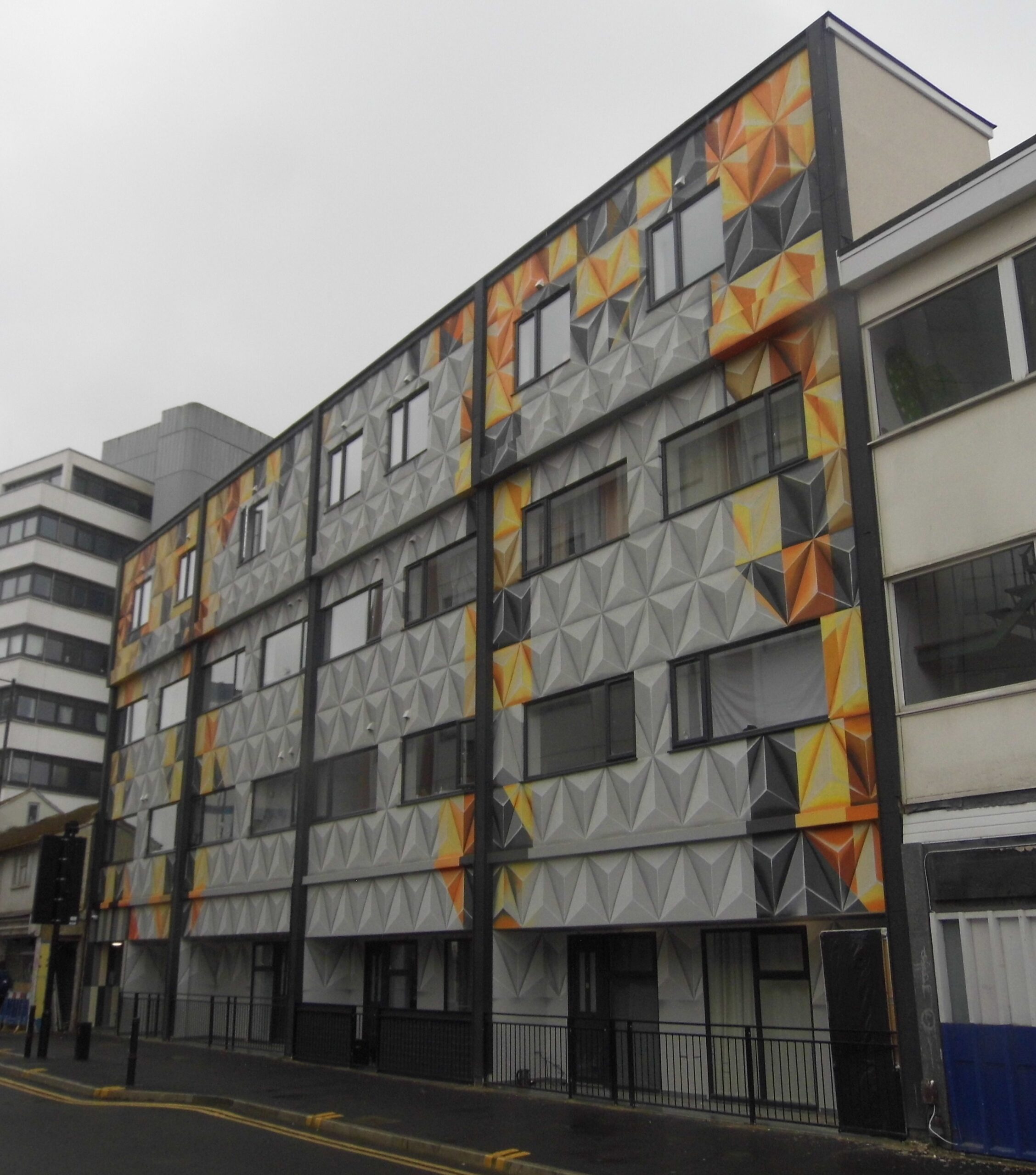
Brightening the area we now have some large-scale mural action. This rather gorgeous creation brings life and colour to Fleet Square – a small area between the Sir Daniel (Wetherspoons) on one side and the Drink Valley, an independent micro brewery on the other.
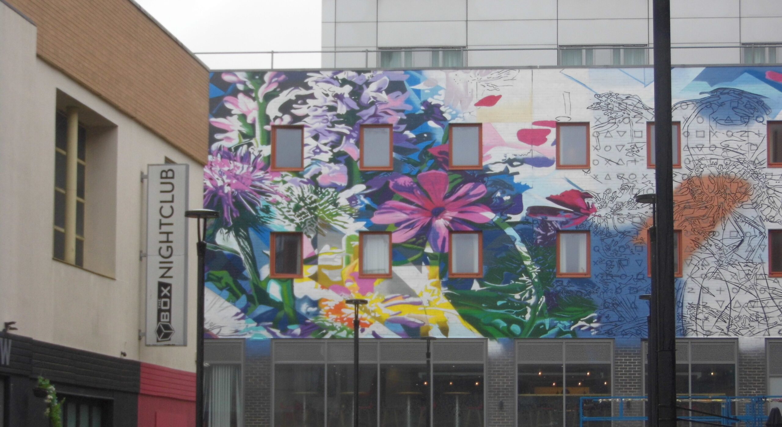
The vibrant striking British wildlife corridor design features native wildflowers and a dragonfly, symbolising biodiversity. It also references the historic Wilts & Berks canal, part of which once ran through Swindon town centre.’
Having visited Fleet Street we now make our way to:



So pleased to read that Fleet Street has found a caring voice. Its building have been deteriorating for a good many years now, my memory of it goes back to the 50s. it was frequented with many small shops that seemed to epitomise this area of Swindon. I think Great Western Cycles hade their shop close bye, where you could buy the latest model of Raleigh cycle, or get your own clapped out bike repaired. It also accommodated ‘The Spot’, which was a small sports shop, locally owned, and where you could purchase anything from a ping pong ball, a set of darts, or it component parts, up to a the latest model Webley Air Rifle or Pistol, all illegal now. The deterioration, dereliction and demolition of some of the old but charismatic buildings is a sad loss to Swindon and has been accomplished at the hands of so say developers is shocking and I can’t see how it has been allowed to happen. One would think that the powers to be have learnt a salutary lesson, yet we see one of the most historic neo gothic buildings that was once the seat of governance for New Swindon, allowed to remain empty and rotting away in the very heart of the Railway Village, which has in the past sought to become a World Heritage Site, of course I’m referring to the Mechanics Institute. People still active today, who care about the appearance of our town, have given over 30 years of their life, first in getting the building listed as a Grade Two * to protect it, only to see it falling into neglect. The Mechanics Institute is in urgent need of TLC, before it too goes the same way as other buildings in Fleet Street, and only Swindon Borough Council can do it.
Oh Jack. I worry about Fleet Street a lot. Those 3 buildings that I mention in particular.
Unfortunately there is nothing to stop developers Fromm buying properties and then sitting on them. Meanwhile, as is the case with Fleet Street, they deteriorate, dragging down the area and anti=social behaviour follows.
It’s a scenario that plays itself out across the land I fear.