Commercial Road 1888-1890.
Before I say anything much about Commercial Road and the area around it, it’s pertinent to say something about the Rolleston estate.*
This estate comprised areas of land lying, in particular, according to Mark Child’s Swindon book, to the south, south-west and south east of the railway village. And they were key to the development of Swindon. In that they comprised a physical link between the new town and the old.
These lands then came into the ownership of the Vilett family – lords of the manor of Eastcott. And then, at length they became the property of Col. William Vilett Rolleston. He inherited them from his uncle, William Vilett. The 1874 bankruptcy of Col. Rolleston rendered their wholesale release to speculative builders impossible but in 1880 there came an annulment of the bankruptcy. Thereafter, the estate’s trustees could only release small plots of land – and at a slower pace than was ideal.
1885 saw the release of land that allowed for the 1890 building of Commercial Road, together with a bridge carrying it over the canal and several streets leading off it on either side. Come1897 and the trustees were able to sell off approx. fifty acres to the east and northeast of the emerging new Swindon. That enabled speculative builders to develop an area that ran roughly between the railway line and where Broad Street is now.
So, if you’ve ever looked at Swindon and thought it looks like it wasn’t planned – that’s because, in essence, it wasn’t planned. The railway village aside, the first planned housing in Swindon was Pinehurst – see Swindon in 50 Buildings.
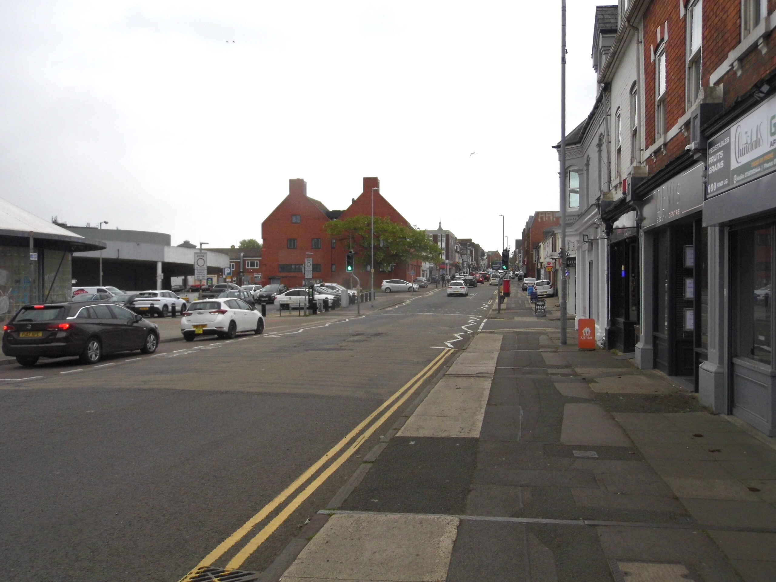
This view is from the market end in the direction of Regent Circus. It forms part of a link between Old Town & the railway village
Swindon’s main shopping street – well almost
Returning to that fount of all knowledge, Mark Child, we learn that the original intention for Commercial Road was for it to serve as Swindon’s main shopping street – a potential it never reached. From 1888 onwards, the street was built up as a spine through the former Rolleston estate. In 1885, this former farmland came on the market enabling builders to put in Commercial Road, soon followed by a number of streets at right-angles towards the north. They linked with Regent Street and others up the sides of the hill, to the south towards Old Town.
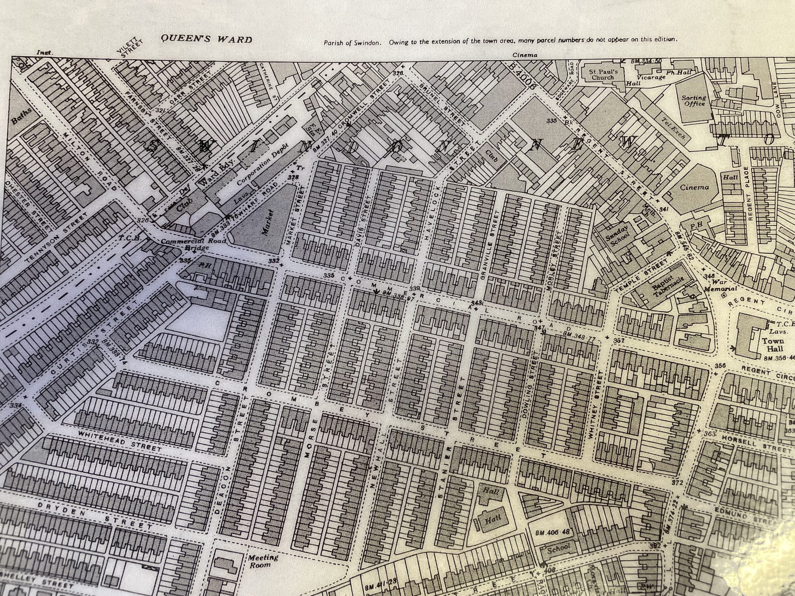
In 1885 only Cromwell Street and Havelock Street ran off Regent Street, both built twenty years previously – and both ending abruptly where they met Rolleston land. 1899 saw Havelock Street extended to meet Commercial Road. Market Street, Davis Street, Granville Street and Morley Street linked Regent Street with Commercial Road.
Meanwhile, on the northern side of the new spine road, the 1890s saw the laying out of Deacon Street, Morse Street, Newhall Street, Stanier Street, Dowling Street and Whitney Street.
Parallel to Commercial Road is Crombey Street (1891) – named for its speculative builder.
On the grid
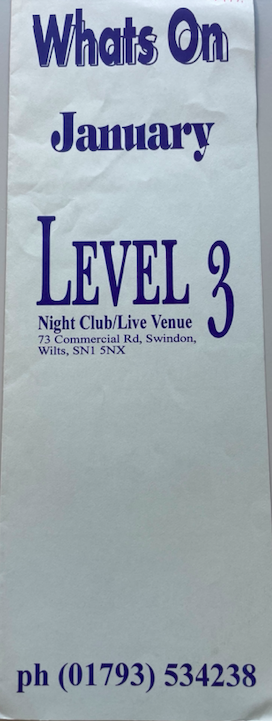
Built to a grid pattern, the area had street-long, single terraces in red brick with some brick or terracotta ornamentation and limestone dressings. The street retained this mix of late 19th c terraced houses, offices and small retail businesses until the 1970s. Then banks and estate agents moved in. Most of the remaining residential properties were bought up during the last two decades of the 20th c . They then underwent remodelling or rebuilding primarily in the service of commerce. Almost all the retail shops disappeared at that time. The street did though, from 1983 to 2013, house the Level 3/Furnace nightclub. Many a Swindon memory made there surely?
The 1990s
When I came to Swindon in the early 1990s this busy thoroughfare was all banks and employment agencies. But the world has changed and so has the street and it’s reinvented itself as a world foods destination – with a smattering of restaurants and coffee shops and barbers.
Points of interest
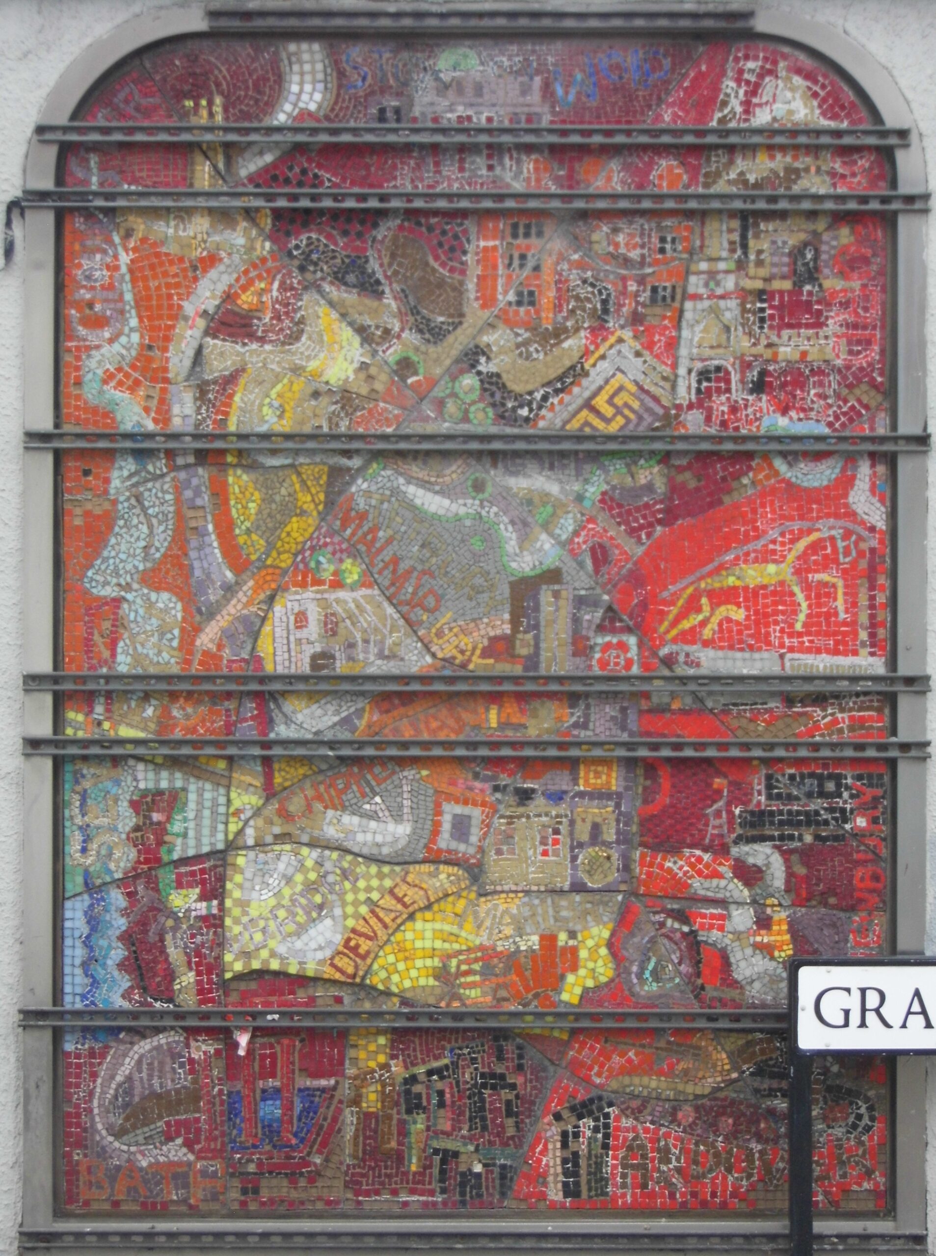
A little way up Commercial Road, on the left-hand side as you walk up towards Regent Circus you’ll see this mosaic on the corner of our eponymous street and Granville Street. It’s on the side of what once was the National & Provincial Building Society before an expanding banking sector swallowed it up. It names a number of Wiltshire towns and features one of the white horses. The rails running across it are remnants of when it had adverts hung upon it.
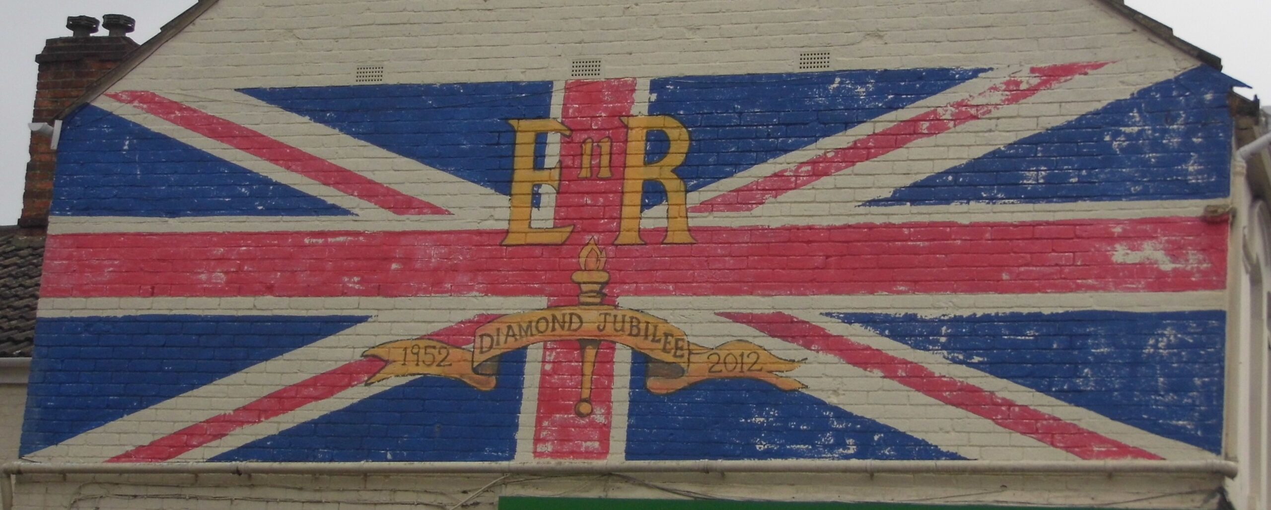
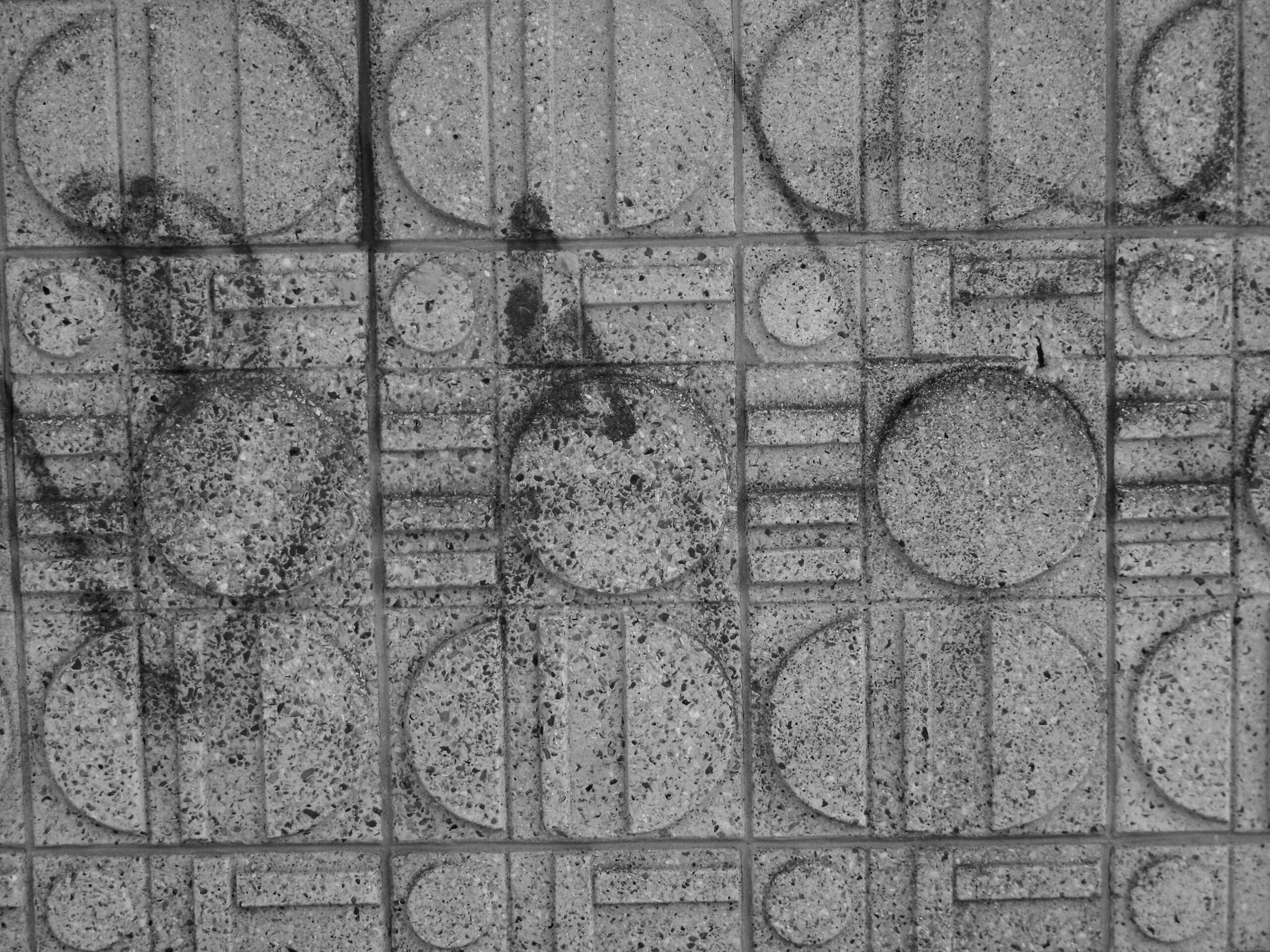
Look out also for this concrete frieze and the 2012 Diamond Jubilee union flag mural on the corner of Temple Street.
The Market – and the Rolleston Arms
There’s been a market at the end of this street, in one form or another, since 1891 with the building of a brick market – it got a roof in 1903. But, come 1977, Swindon had the shiny new Brunel Centre. And the powers-that-be decided it had to go and you can guess what happened next …
The current incarnation opened in 1994. The incumbent (at that time) administration closed it in 2017, throwing out decent businesses and it’s stood rotting ever since. So that’s all good …
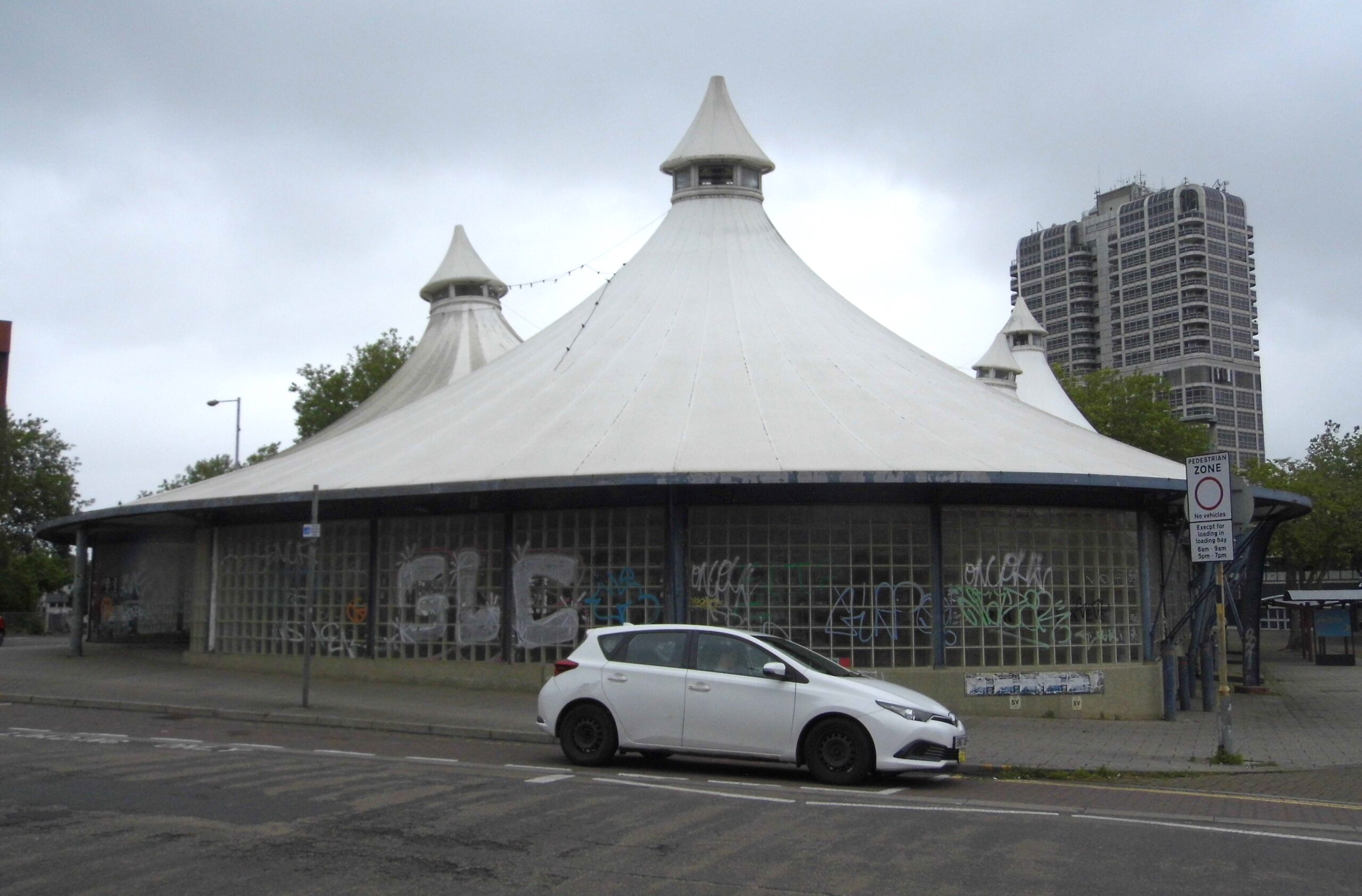
As much as I try to be positive about Swindon things, I’ve struggled with this. Take a proper look at the ‘roof’ and you’ll see that at least one of the panels is install back to front. So of course it’s got mouldy and manky.
*The Rolleston Arms pub on the end of Commercial Road, across from the market site, does of course take its name from the Rolleston estate.


Hi Angela.
This is quit a fulsome account of Commercial Road and its environs beginning in 1888 until its present day, and of course its nature, if not its purpose is bound to have changed since the first ripples appeared into what became the epicentre for commerce in early then later Swindon. But I am writing as a disabled mobility scooter user, and I must say I cannot share any enthusiasm at all for the cluttered appearance of the area and the crowded and broken pavements that extend it whole length. The pavements are not necessarily crowded with shoppers but by cars, vehicles, shop signage and other assemblages, vans are parked half on and off the pavements, cars are parked in front of shops on the pavements, which have been broken and get worse daily by constantly being used for parking or unloading vehicles. The pavements have been patched, mended, drilled and filled, and for a wheel chair or scooter user it feels like traversing the surface of the moon, apart from the discomfort it can also be damaging for a disability scooter to take the sudden shocks from potholes and drops in shattered paving stones. In some places there was barely enough room for my scooter to pass between a vehicle and an obstacle. I also found some of the dropped curbs were in poor shape and needed extra care not to be shaken out of my seat. I would say it is impossible for a wheelchair user to use Commercial Road in comfort; the pavements are too rough. I was travelling from Regent Circus towards Milton Road. It is a journey that I will avoid having to make any time soon…even if then. There are other pavements I have recently discovered that are worse for disability scooters, some that I consider to be dangerous with the fear of tipping over sideways, but that is a different story. The council needs to be aware of the state of pavements when it comes to the comfort and safety of disability scooter users.
Hello Jack
Oh, I quite agree it’s all rather a mess! It’s not an attractive street is it?
It’s interesting that you mention the state of pavements and mobility scooters. My daughter lives in a rather nice village in Surrey and the pavements there are, on the whole, simply dreadful. Then there’s all the 4x4s selfishly parking where there’s dropped kerbs for access to the shops.
It’s a nightmare for prams/pushchairs – and yes mobility scooters. I often think that. So I can appreciate and empathise with your frustration.
We have a new administration Jack – start filling their inboxes! 🙂
All best.